Bacheralm - Metzgeralm

Hiking

favorite_borderfavorite
play_arrowpause
  • EasyLevel
  • access_time4:45 hDuration
  • arrow_right_alt13,0 kmDistance
  • terrain1029 mHighest point
  • trending_up573 mUphill
  • trending_down573 mDownhill
  • Show map
0350-13 ©FranzGERDL _REG-St.Johann 6940.jpg

Tour information

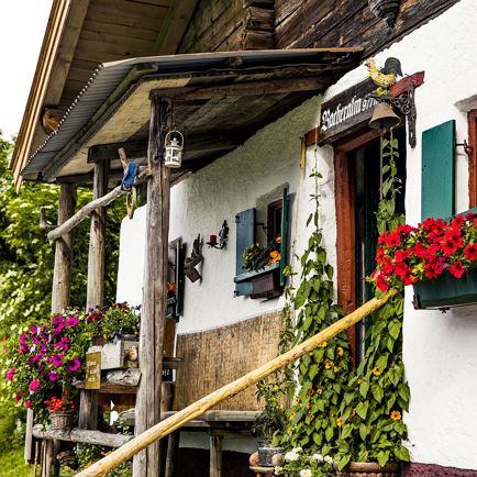
The leisurely hike starts in the center of Kirchdorf. First, walk between the municipal office and the church in the direction of Weng/Erpfendorf. Turn into Leerbergstraße and after about 400 meters follow the hiking trail to Gasteig. Along the Leerberg, the trail leads steadily up and down in the forest until you reach the hamlet of Unteranger. Here you branch off to the reservoir. Through the forest, the hiking trail leads up to the oldest reservoir in Tyrol. The 10 meter high dam wall was built in 1901/1902. Via a small hamlet you reach a pasture area with alpine pasture character. After a short forest section, you are directly opposite the imposing Wilder Kaiser. Cross-country the hiking trail goes up and joins the forest road shortly before the alpine hut. After a few minutes you already have the idyllic Bacheralm in view. The dairy woman at Bacheralm is a certified herbalist and offers hikers homemade juices and herbal infusions as refreshment. In a few minutes you reach the Metzgeralm. Here it is worth taking a detour to the summit cross. Along the forest road you hike down in the direction of Gasteig/Kramerhof. Pass the valley station of the winter toboggan run and walk to the main road. Walk a short distance along the road in the direction of Kirchdorf until you reach Café Erika. Here you march cross-country next to the house to the two picturesquely situated mountain farms "Vorder and Hinter Schwaiglern". Via an ancient path, which used to be used to visit the church on Sundays and holidays, you come to the newly restored farm "Point". Follow the road until you reach the hiking trail that leads through the forest back to the starting point.

Read more

Info

Bacheralm - Metzgeralm

Features

  • check easy
  • check
  • Asphalt, gravel, forest and meadow road
  • - outdoor clothing
    - sturdy shoes
    - Sufficient food and drinks
    - First aid kit
    - Mobile phone with full battery & charger
    - Hiking map & guide literature
    - GPS device or download the GPS data to your mobile phone if necessary
    - Sun protection (sunglasses, sun cream, cap)
    - Rain protection
    - Cash
  • Coming from Kitzbühel/Oberndorf and St. Johann in the Tirol, follow the B178 to Kirchdorf and turn left onto Dorfstraße.
    Coming from Waidring/Erpfendorf, drive in to the direction of Kitzbühel, follow the B178 to Kirchdorf and turn right into the center.

    This will take you to the St. Johann in Tirol region: 
    https://www.kitzbueheler-alpen.com/en/stjo/getting-here/holidays.html
  • Public transport
    Postbus 4012 exit Kirchdorf i. T. Bundesstraße
    Postbus 4000 exit Kirchdorf i. T. Ort

    Or conveniently with the free OKTO hiking bus in the summer season from Monday to Friday,
    Journey times here:kitzalps.cc/mobile
  • Free parking in Kirchdorf i. T. centre (information office, education centre)

Restaurants & infrastructure

Jagdschlössl

Jagdschlössl
Jagdschlössl
Open todayKirchdorf in Tirol
favorite_borderfavorite

Landgasthof Mauth

Landgasthof Mauth
Landgasthof Mauth
Open todayKirchdorf in Tirol
favorite_borderfavorite

Similar

Lake Schwarzsee

Lake SchwarzseeEasy
Lake Schwarzseeaccess_time4:30 harrow_right_alt14,5 kmfavorite_borderfavorite

Bichlach-Runde

Bichlach-RundeEasy
Bichlach-Rundeaccess_time3:30 harrow_right_alt10,5 kmfavorite_borderfavorite