Gipfelkreuz des Gerstinger Jochs

Gerstinger Joch

One step closer to heaven

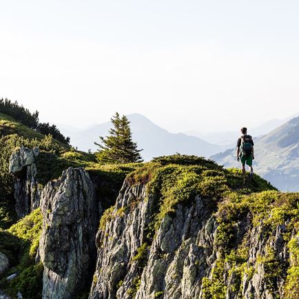
Gerstinger Joch with its 2,035 m is accessible from both side valleys of Brixental Valley, Spertental and Windautal valleys. From both sides, a difficult hiking trail leads up to the summit, so you should be sure-footed and not too scared of heights.

Data & Facts

  • checkDuration: 5.5 hours

  • checkDistance: 12.2 km

  • checkHighest point: 2,035 m

  • checkElevation gain uphill: 1,200

  • checkElevation drop downhill: 800

  • checkLevel: difficult / black mountain path

  • checkEquipment: alpine mountain equipment

  • checkStarting point: Gasthaus Steinberg hotel in Windautal Valley

Special waypoints:
Part of the hike leads along the KAT-Walk, the long-distance hiking trail through the Kitzbühel Alps

Snack stops: Gasthaus Steinberg, Alpengasthof Labalm

  • Mountain pond on the way
    On the way, you’ll come past a small mountain pond
  • Mystical ambience on Gerstinger Joch
    There is a mystical ambience on the way to Gerstinger Joch.
  • Pure nature on Gerstinger Joch
    On a hike you can experience great views.
  • Narrow summit ridge
    Those who want to make their way up to the summit of Gerstinger Joch mustn’t be too afraid of heights. The hiking trail leads across a narrow ridge.
  • Sunset on Gerstinger Joch
    Be it rocky or grassy mountains, in the Kitzbühel Alps there is something for all hiking fans.
  • Divine views on Gerstinger Joch
    On Gerstinger Joch you’ll find divine views.
  • Hiking trail Gerstinger Joch
    The hike to Gerstinger Joch is not easy, you do need some fitness and surefootedness.

Interactive map

Plan your tour to the Gerstinger Joch with our interactive map. In addition to the specific data and facts about the tour, you will find further, specific route information, an altitude profile of the tour and GPS data to download. Directions as a PDF are also waiting for you.

More

Further tour suggestions

Wappenweg

WappenwegMedium
Wappenwegaccess_time6:00 harrow_right_alt15,5 kmfavorite_borderfavorite

Kröndlhorn

KröndlhornMedium
Kröndlhornaccess_time7:00 harrow_right_alt13,5 kmfavorite_borderfavorite

Gamskogelhütte

GamskogelhütteEasy
Gamskogelhütteaccess_time3:30 harrow_right_alt28,5 kmfavorite_borderfavorite

Schwarzkogel

SchwarzkogelMedium
Schwarzkogelaccess_time6:30 harrow_right_alt8,9 kmfavorite_borderfavorite

Lärchenbergalm

LärchenbergalmMedium
LärchenbergalmPartially openaccess_time3:30 harrow_right_alt9,0 kmfavorite_borderfavorite

Rauher Kopf

Rauher KopfMedium
Rauher Kopfaccess_time6:00 harrow_right_alt15,0 kmfavorite_borderfavorite