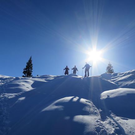
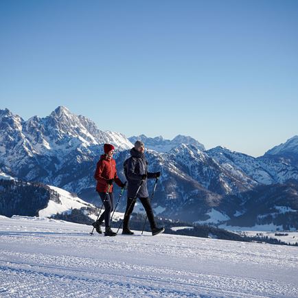
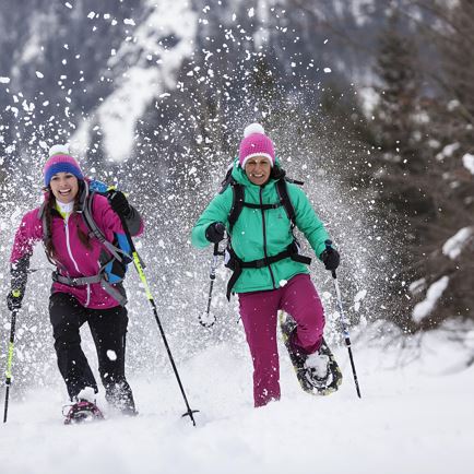
Snowy shoe walking in the PillerseeTal

Are you a member of a national sports club? Then you are in the right place in PillerseeTal! Five permanent IVV hiking trails are available in the region. Hike at your own pace and get the stamp for the kilometres you hike after your performance. Along the routes you will find self-checking points, which are needed for the evaluation stamp. In winter, a permanent IVV cross-country ski trail with a length of 6 km is available.
checkStarting tickets are available at the PillerseeTales information offices during the official opening hours.
checkThe numbers of the self-inspection points must be entered in the starting card.
checkA separate starting card is required for each permanent hiking trail.
checkThe hiking trails are generally marked with the public transport signs.
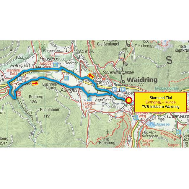
Follow the village road in a west direction until the main road. After the underpass keep left and follow the foot and cycle path towards Enthgrieß to the distillery Seibl. After the distillery Seibl through the underpass along the path to the farms. After the farms follow the field and meadow path to the Blachholzkapelle, following the path towards the village to the starting point.
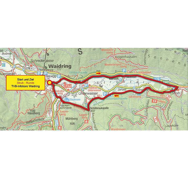
From the village fountain along the Hintergasse to the main road. Before the underpass keep right to the Haselbach and cross it. Then along the dam to Gasthof Strub. Back a bit along the old road, then left on the forest path (Jakobsweg) to the Kneipp plant and on to the Schäferaukapelle. Along the Mühlberg to the Hackenschmiede and back to the start.
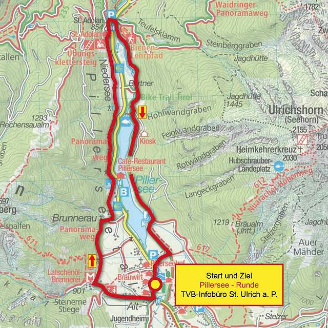
From the centre, follow the main road southwards to the restaurant Seewirt. There turn right towards Latschenölbrenne-rei (Mack) – shortly before the Latschenölbrennerei turn right again on the trail (Kreuzweg) to the Adolari inn. After the inn Adolari cross the road, then right, going south, always stay on the road. Along the Pillersee back to the starting point in the centre.
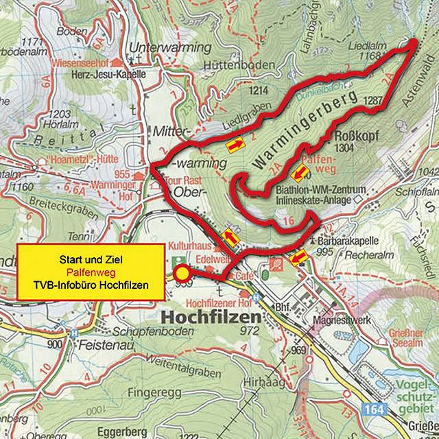
From the municipal office towards the church and via Herrngasse to Warming. After the underpass left to the first bridge. Then turn right on the circular path Buchensteinwand, after about 300 m turn right towards Liedlgraben, along the gravel road. Shortly before the end of the path, right along the path to the top of the hill, at the top, right on the forest path to the barrier. Then follow the forest path downhill to the TÜPL building and right back to the village.
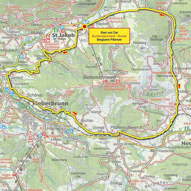
From the starting point (parking lot Bergbahn Pillersee) in west direction. Take a slightly ascending dirt road (left) to the circular path Buchensteinwand (towards the hamlet of Mühlau). At the fork turn left again, continue to the cool Klause, along the Rettenbach to Fieberbrunn. Follow the circular path past Pfaffenschwendt to Hochfilzen. Over the Wiesensee towards St.Ulrich am Pillersee. Past the hamlet Flecken to the starting point.
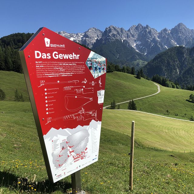
Hiking-Tip: Biathlon WC trail
THE biathlon experience for the whole family in Hochfilzen: Valuable insider knowledge, interactive stations and a puzzle rally await you!
A continuous sign will guide you to the next station. On the pylons you will find valuable information about biathlon sports - partly with interactive elements!

Event-Tip: Hiking Europiade
At the end of May 2024, the PillerseeTal is the scene of the 7th Hiking Europe. Around 1,500 participants from more than 20 nations will explore the hiking network in the region over three days.

Permanent IVV cross-country skiing track
In St. Ulrich am Pillersee you can also collect kilometers on the trail and secure a stamp of appreciation.
The "Au Lope" with a length of about 6 km and two self-check points is prepared daily in winter and is ideal for beginners as well as ambitious cross-country skiers.
Stamp cards and stamps for the permanent trail can be obtained at the information office St. Ulrich am Pillersee.
Note: The cross-country trails in the PillerseeTal are subject to a fee!
Today 2025-02-22
Tomorrow 2025-02-23
Tomorrow 2025-02-24
Tomorrow 2025-02-25