Steinbergstein_Kitzbüheler Alpen - Brixental_Christoph Stöckl (2019)_LIGHT3

Steinbergstein Mountain

A summit rich in variety in Windautal Valley

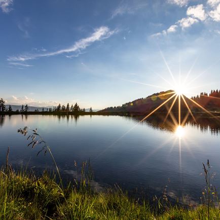
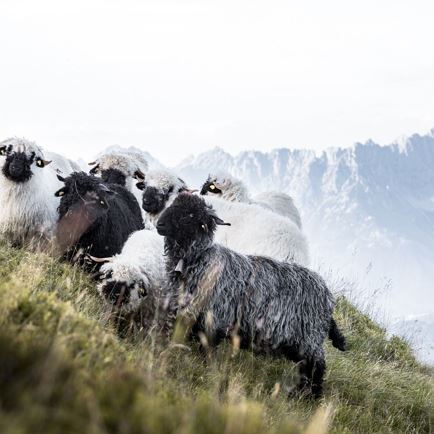
Steinbergstein with its 2,215 m has plenty of variety to offer. Getting to the summit requires some fitness. The many impressions of the varied scenery, which range from the pasture area all the way to the cobble fields far above the tree line, make up for everything. The summit also has some surprises in store. Often you’ll spot rarely seen Alpine inhabitants.

Data & Facts

  • checkDuration ascent: approx. 3.5 hours

  • checkDistance ascent: 4.4 km

  • checkHighest point: 2,215 m

  • checkElevation gain: 1,200

  • checkLevel: medium-difficult / red mountain path

  • check equipment: alpine mountain gear

  • checkStarting point: Windautal - Ahornau

Snack stops:
Gamskogelhütte, Gasthaus Steinberg, Gasthof Jagerhäusl --> snack stops only possible at the beginning or end of the hike

Other:
You can also combine the tour up to Steinbergstein with a hike up to Lodron.

Lagfelden-Steinbergstein

  • MediumLevel
  • access_time3:30 hDuration
  • arrow_right_alt4,4 kmDistance
  • terrain2215 mHighest point
  • trending_up1200 mUphill
  • Details
  • Steinbergstein_Kitzbühel Alps - Brixental Valley_Christoph Stöckl (2019)_LIGHT1
  • Steinbergstein_Kitzbühel Alps - Brixental Valley_Christoph Stöckl (2019)_LIGHT2
  • Steinbergstein_Kitzbühel Alps - Brixental Valley_Christoph Stöckl (2019)_LIGHT4

Interactive map

Plan your tour to the Steinbergstein with our interactive map. In addition to the specific data and facts about the tour, you will find further, specific route information, an altitude profile of the tour and GPS data to download. Directions as a PDF are also waiting for you.

More

A ridge hike: Steinbergstein – Lodron

  • HardLevel
  • access_time7:00 hDuration
  • arrow_right_alt16,2 kmDistance
  • terrain2215 mHighest point
  • trending_up1300 mUphill
  • trending_down1300 mDownhill
  • Details

Further tour suggestions

Almrosenweg

AlmrosenwegMedium
Almrosenwegaccess_time6:00 harrow_right_alt15,5 kmfavorite_borderfavorite

Obwiesen

ObwiesenEasy
Obwiesenaccess_time1:30 harrow_right_alt5,7 kmfavorite_borderfavorite

Gamskogelhütte

GamskogelhütteEasy
Gamskogelhütteaccess_time3:30 harrow_right_alt28,5 kmfavorite_borderfavorite

Urzeitweg

UrzeitwegMedium
Urzeitwegaccess_time6:00 harrow_right_alt15,5 kmfavorite_borderfavorite

Schwarzkogel

SchwarzkogelMedium
Schwarzkogelaccess_time6:30 harrow_right_alt8,9 kmfavorite_borderfavorite

Naturlehrpfad

NaturlehrpfadEasy
Naturlehrpfadaccess_time3:00 harrow_right_alt8,0 kmfavorite_borderfavorite